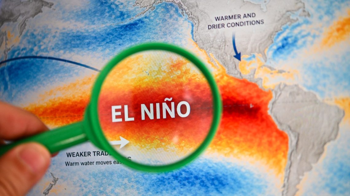
El Niño is intensifying across the Pacific and might reach ‘super’ status later this year. Several forecasters indicate a strong climate event could occur, with impacts lasting into 2027.
Understanding El Niño
The National Oceanic and Atmospheric Administration (NOAA) characterizes El Niño as the warm phase of the El Niño-Southern Oscillation (ENSO). This recurring climate pattern in the Pacific influences ocean temperatures and disrupts tropical wind and rainfall patterns, yielding global weather impacts.
During winter, El Niño often results in wetter-than-average conditions in the Southern U.S. and warmer, drier conditions in the North.
Some meteorologists use the term ‘super’ El Niño to describe exceptionally strong events, typically when ocean temperature anomalies exceed 2 degrees Celsius above average. These occurrences are uncommon, with significant episodes only happening a few times since 1950, such as in 1982-83, 1997-98, and 2015-16.
Probability of ‘Super’ Status
AccuWeather forecasts, updated on August 3, suggest there is now more than a 90 percent likelihood that El Niño will become a ‘super El Niño’ by the end of the Atlantic hurricane season. Although this pattern could reduce tropical activity, a quieter season doesn’t guarantee it will be harmless.
A stronger El Niño increases wind shear over the Atlantic, making it challenging for tropical storms and hurricanes to form or strengthen. Alex DaSilva, AccuWeather’s lead hurricane expert, notes that as El Niño strengthens, the likelihood of a less intense hurricane season increases. The Atlantic hurricane season started on June 1 and continues until November.
Fox Weather reports that El Niño continues strengthening, potentially becoming one of the strongest recorded events by fall or winter. Currently, water temperatures in key Pacific areas are 1.5 degrees Celsius above average, classifying the event as ‘strong.’ For ‘super’ status, Pacific waters must maintain a 2 degrees Celsius rise for at least three months.
Fox Weather warns there’s no definitive timeline for reaching this threshold, and the Fox Forecast Center doesn’t expect a ‘Super El Niño’ declaration soon.
Recent Historical Patterns
Since 1970, the five recorded ‘Super El Niño’ events usually transitioned swiftly into either neutral or La Niña conditions. The 1997 event stands as a possible comparison, though forecast models indicate the current El Niño might become even stronger.
As of Monday, a Polymarket prediction market suggests an 88 percent chance of a ‘Super El Niño’ during the winter of 2026-27.
CPC Forecasts Ongoing Intensification
The Climate Prediction Center (CPC) updates from July 9 indicate El Niño will continue strengthening through 2026’s end. They predict a 97 percent chance it will persist into early spring 2027, and an 81 percent probability for a ‘very strong’ El Niño in the October-to-December period.
This could mark one of the largest El Niño occurrences since records began in 1950. However, CPC states that while stronger El Niños increase the likelihood of expected weather patterns, they don’t produce typical impacts everywhere.
 Turning Home Food Waste into Compost: A Guide
  Chicagohenge: When Sunlight Aligns with City Streets
  Fat Bear Week 2026: A Look at the Contest and Its Competitors
  California Governor Declares Statewide Emergency Ahead of El Niño Storms
  EPA Rollbacks and the Impact on Indiana Communities
  The Impact of Battery Innovations on Renewable Energy