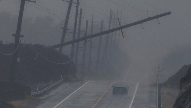
The Atlantic hurricane season is experiencing an unprecedented lull, largely due to a powerful El Niño.
No hurricanes have formed yet this year, defying expectations during what is typically the peak time. According to the National Hurricane Center, the season, which spans from June to November, usually hits its stride between August and October. As of now, only five short-lived tropical storms have been recorded.
On Saturday, 2026, a new record was set for the longest stretch into a season without a hurricane reaching winds of 64 mph. This is considered a significant marker at least since the satellite era began, according to Nick Novella, a meteorologist at the Weather Prediction Center. Historical records from before the 1950s are unreliable due to incomplete ocean monitoring.
Phil Klotzbach, a hurricane expert from Colorado State University, notes that overall hurricane activity, measured by the number of storms, their intensity, and duration, is at a record low post-1950. Right now, storm activity is only 7% of what is normal for this time of year.
The 2026 annual hurricane report by experts at Colorado State University had forecasted nine named storms in the Atlantic basin. Despite the calm, people should not become complacent. History shows that even amid El Niño, a single storm can have catastrophic effects, as was the case with Hurricane Andrew in 1992.
El Niño’s Impact on Storms
Kristen Corbosiero, an atmospheric science professor at the University at Albany, describes the conditions in the Atlantic as extremely unfavorable for forming tropical cyclones. The region faces a ‘triple whammy’ of wind shear that disrupts storms, dry air that weakens them, and oppressive downward winds.
El Niño, a natural warming pattern in parts of the equatorial Pacific, exerts a strong influence by enhancing these conditions. It typically occurs every two to seven years, last appearing in 2023, and currently, it’s significantly affecting the Atlantic.
Klotzbach highlights that the particularly strong wind shear in the Atlantic, where strong easterly winds clash with westerly winds at altitude, is tearing storms apart. The wind shear measures about 45 mph more than a developing tropical cyclone can endure.
Dry air and African dust further hinder storm formation, while high pressure in the Atlantic suppresses upward air movement, creating an inhospitable environment for storm development. These conditions persist despite record-hot ocean waters, a typically favorable factor for storm formation.
Future Implications
Looking ahead, the disconnect between warm waters and a rapidly heating atmosphere suggests that the next hurricane season could be busier as El Niño subsides, says MIT meteorology professor Kerry Emanuel. This delay means warmer waters may contribute more to storm formation next year.
Pacific Ocean Activity
The eastern Pacific experiences an upswing in tropical cyclone activity during El Niño, contrasting with the Atlantic’s quiet season. The eastern Pacific sees almost double its usual storm activity, while the central Pacific exceeds its norm by about 40%.
Hawaii has already been hit twice. Hurricane Lowell affected the western islands, leading to extensive power outages and heavy rain. In August, Hurricane Lala impacted the Big Island with intense rain and wind.
Forecasters had predicted a tranquil Atlantic season due to El Niño, yet the extent of the calm surprises many experts. Despite this, plans and preparations for potential future storms remain crucial.
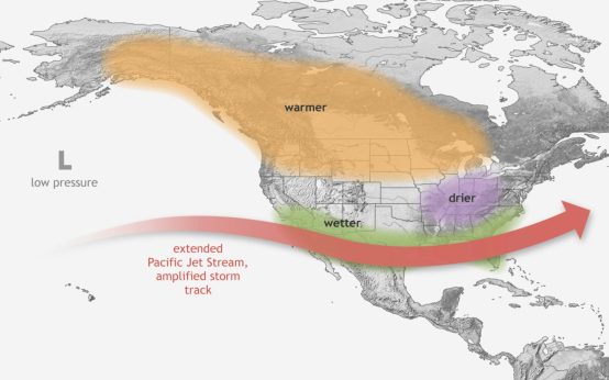 Increased Winter Weather Expected in Major Cities Due to Strengthening El Niño
  Lobster Boats and the Surveillance Debate
  Impact of Construction on Big Bend National Park’s Border
  Court Rules Against Federal Order on Coal Plant Operations
  New Beach Hazard Warnings for Lake Michigan
  El Niño’s Impact: Rising Sea Levels Threaten U.S. West Coast