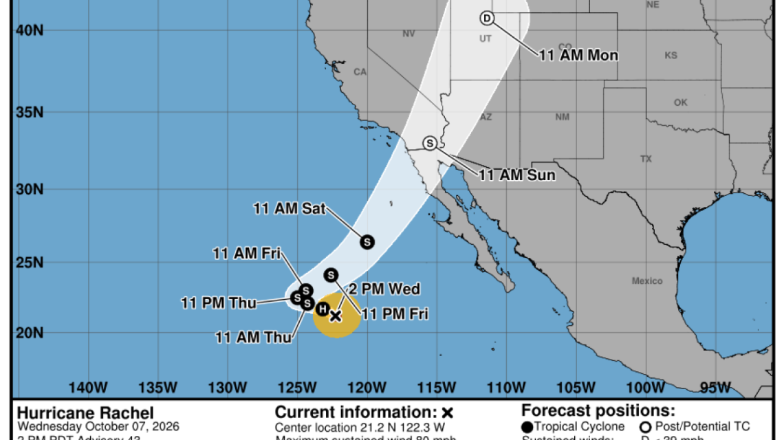
Hurricane Rachel, situated in the Pacific Ocean, poses a threat of coastal flooding in Southern California and may bring substantial rain to the area over the weekend and early next week. Meteorologists caution that south-facing beaches such as Long Beach Peninsula, Catalina Island, and the shoreline from Malibu to Ventura face significant flooding risks due to Rachel’s activity, driven by an unusually active hurricane season influenced by El Niño.
The arrival of a Kelvin wave, associated with El Niño, further heightens the flood risk by potentially raising sea levels by 6 to 12 inches. Elevated sea levels present increased challenges for California’s coast.
Ryan Kittell, a meteorologist at the National Weather Service in Oxnard, observed that the peak flooding risk is anticipated to occur on Sunday. He noted, It seems fairly probable that we will see considerable beach erosion, especially during the Sunday time frame. Those areas have been previously affected by coastal flooding events and remain extremely susceptible with limited beach space remaining.
Tides are expected to rise 1 to 1.5 feet above usual levels due to unusually warm ocean temperatures induced by El Niño. Kittell mentioned potential isolated damage issues, though perhaps less severe than those seen during Labor Day weekend, where some homes in Malibu, Long Beach, and Dana Point faced significant swell-induced damage from Hurricane Marie.
Experts suggest that this El Niño could become the most potent in the modern era, dating back to 1950. Hurricane Rachel, initially a Category 1 storm as of Wednesday, is forecast to weaken as it approaches Southern California, according to the National Hurricane Center. The storm’s trajectory changed from northwest to a sharp right turn and is influenced by two unusual low-pressure systems from the north, likely interacting with remnants of Rachel, particularly its moisture, forming a new system moving over the region.
Rainfall Expectations
Kittell stated that the time frame from Sunday night to Monday offers the highest likelihood for rain. There’s a 70% to 90% chance of precipitation in L.A. and Ventura counties between Saturday and Tuesday, peaking Sunday night to Monday night. For marathon participants at the 2XU Long Beach Marathon on Sunday morning, he projected a 40% to 50% chance of daytime rainfall, advising participants to prepare for possible light showers.
The forecast suggests rain accumulation of one-quarter to three-quarters of an inch, potentially more in mountainous regions. Rain rates are projected to stay below a quarter inch per hour, reducing risks of debris flow and landslides. In San Diego County, Orange County, and the Inland Empire, rain likelihood is set to increase from Sunday through Tuesday, peaking Sunday and Monday, as per the San Diego weather service office.
In the San Francisco Bay Area, authorities have warned of possible inundation up to 1.2 feet above ground level in low-lying coastal and tidal areas, as per the Monterey weather service office.
Windy Conditions and Rip Currents
Forecasts predict Sunday as the windiest day, with south-to-west winds gusting between 20 to 35 mph. It doesn’t appear ideal for boating,
Kittell mentioned. Additionally, strong rip currents and hazardous waves will heighten drowning risks for beachgoers. The possibility exists for locally strong winds, as well as occasional thunderstorms,
Kittell noted, alongside concerns about coastal flooding, high surf, and potent rip currents.
These worries are compounded by anticipated high tides and the arrival of a Kelvin wave.
Kelvin Wave and El Niño Impact
El Niño influences Kelvin waves, which have been traveling along the Americas’ coastlines for several weeks, bringing increased water temperatures and higher sea levels. When combined with storm surges and high tides, Kelvin waves can exacerbate coastal flooding. Despite their relative obscurity until recently, Kelvin waves play an integral role in El Niño by triggering atmospheric changes that affect global weather.
Michael Jacox, a NOAA Fisheries’ Ecosystem Science Division oceanographer, explained that coastally trapped
Kelvin waves must follow shoreline boundaries, with the coast to their right in the Northern Hemisphere.
The latest wave is expected to maintain elevated sea levels for an extended period. According to Dillon Amaya of North Carolina State University, the initial wave edge likely passed Los Angeles and may have reached north of San Francisco. Further inundation is possible as Kelvin waves progress. Sea levels will remain elevated for months,
Amaya stated, citing data indicating another coastal wave related to El Niño traveling from the tropics.
The last major El Niño event spurred five to six such waves, Amaya noted. Climate change-induced sea level rise over decades has heightened Kelvin waves’ recognition as a hazard, with California’s coastline seeing a foot increase over the past 125 years.
El Niño Update
On Thursday, NOAA’s Climate Prediction Center increased the probability of a historic El Niño from 75% to 83%, forecasting a record-breaking event. El Niño traditionally surfaces every two to seven years, correlating warm ocean waters with atmospheric alterations to influence worldwide weather.
In Southern California, significant El Niños often correlate with heightened rainfall, as seen in the 1982-83 and 1997-98 events, which led to devastatingly wet winters. However, during the 2015-16 El Niño season, California experienced coastal erosion rather than increased rainfall, another El Niño hallmark.
Significantly high Pacific Ocean temperatures are currently observed, surpassing historical records. Temperatures beneath the ocean surface are exceeding baseline levels by over 18 degrees.
The Climate Prediction Center stated, An event of this magnitude increases the likelihood of El Niño-consistent impacts, although not absolute.
Heat Perspective
Extreme heat in Southern California is likely to subside by Thursday or Friday, transitioning from highs of 95 to 105 degrees on Wednesday to the 70s by Sunday or Monday.
On Thursday, temperatures will remain elevated, with forecasts indicating highs of 101 in Paso Robles, 100 in Woodland Hills, 99 in Santa Clarita, 96 in Burbank, Pasadena, and Palmdale, 94 in downtown L.A., Thousand Oaks, and Santa Ynez, and 92 in Long Beach. An extreme heat warning will persist across Southern California until Thursday evening.
Heat-related illness risks and significant fire plumes will be high through Thursday, Kittell said.
Residents are advised to limit outdoor activities to early morning hours and stay indoors during afternoons and evenings. Initial signs suggest rising temperatures toward late next week and the following week, though unlikely to mirror the recent extreme highs.
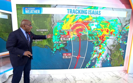 Hurricane Isaias: Impacts and Preparations
  Fauci’s Diaries Reveal Criticism of Trump and More
  U.S. Forces in Japan Face Curfew Following Marine’s Arrest
  Memphis City Council Meeting Ends in Chaos Over Data Center Vote
 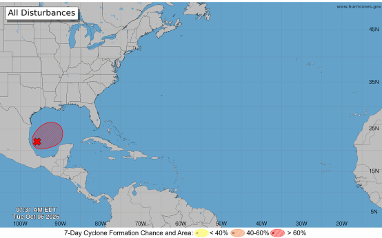 Tropical Storm Isaias: Potential Threats and Preparations
 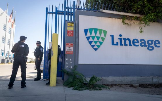 Criminal Investigation Underway at Lineage Cold Storage Warehouse