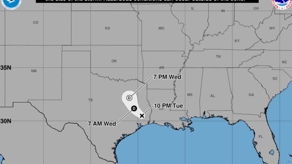
Tropical Storm Edouard is impacting parts of Texas with heavy rain, prompting concerns about flooding and travel disruptions as it progresses inland from the Gulf Coast. Although the storm has weakened into a tropical depression, it continues to pose a major threat due to widespread rainfall that could result in dangerous flash flooding across various regions.
Edouard’s Path and Impact
Spaghetti models show Edouard moving northward through eastern and central Texas. The most intense rainfall stretches inland from the upper Texas coast. While the precise path is uncertain, predictions agree on a broad impact area, aligning with forecasts of severe rainfall and flood risks in these locations.
Shift From Wind to Rain
The National Hurricane Center (NHC) indicates that, while tropical storm force wind gusts may still occur near the storm’s center, the primary concern is now heavy rainfall. The agency warns of potential river and flash flooding, especially in urban areas, from the upper Texas coast through east-central Texas and into southwest Louisiana.
Preparations in Affected Areas
Communities in southeast Texas are preparing for the storm’s effects. In Montgomery County, emergency managers are mobilizing equipment and resources, such as rescue boats, in response to flooding fears. Schools like Conroe ISD and Willis ISD have canceled classes, and some government offices have closed. Jason Millsaps from the Montgomery County Office of Homeland Security and Emergency Management highlights the risks of heavy rain bands lingering over areas, depositing large amounts of rain quickly. Barricades are in place at flood-prone sites throughout the county.
Widespread Flood Watches
The National Weather Service (NWS) has issued Flood Watches for parts of northeast, east-central, and southeast Texas. In Henderson County and surrounding areas, 1 to 3 inches of rain is predicted, with isolated totals reaching 4 to 6 inches by Thursday night. Excessive runoff could induce flooding in rivers, creeks, streams, and low-lying zones.
Further south and east, regions including Brazos, Chambers, Harris, Liberty, Montgomery, and others are under broader Flood Watches. Here, forecasters predict more severe impacts with 3 to 6 inches of rain expected, and some areas potentially receiving 10 to 15 inches, particularly east of Interstate 45. Intense downpours could bring rainfall rates of 3 to 4 inches per hour.
Continued Rain and Risk
Edouard’s remnants are expected to keep spreading moderate to heavy rain through Wednesday and Thursday across eastern Texas. Flood risks remain due to potential repeated rainfall over already saturated areas. Emergency officials advise residents to follow forecasts and heed flood alerts if conditions worsen. Authorities stress the importance of not crossing flooded roads, as water depths can be misleading and conditions change quickly.
The state has responded with official statements regarding preparations for the tropical weather threat.
Main Threat
For many in Texas, the main threat from Edouard is no longer high winds. Rather, the storm risks leaving serious flooding in its wake, affecting roads, neighborhoods, and water systems long after weakening.
 Tragic Incident in Frankfort: Domestic Related Homicide Claims Toddler’s Life
  Royal Family Faces New Challenges with Sussexes’ Return
  North Carolina’s Struggle with Post-Hurricane Rebuilding Efforts
  Neighbors Battle Unlawful Construction as Chicago’s Historic Wacker House Faces Alteration Challenges
  Tragic Death of Haitian-Born College Student Highlights Immigration Challenges
  Notable Developments in U.S. Politics and Elections