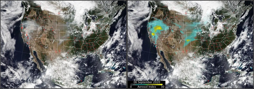
The Growing Threat of Firestorm Clouds
As wildfires continue to increase in intensity worldwide, researchers have launched an airborne mission to study severe storm clouds formed over these intense blazes. Known as pyrocumulonimbus (pyroCb) clouds, these firestorm phenomena can inject as much smoke into the stratosphere as volcanic eruptions do. They contribute to extreme weather conditions, including lightning and firenadoes, while their unpredictable nature poses risks to residents and emergency responders.
INSPYRE: A Mission to Study PyroCbs
This summer, a collaborative team of scientists from NASA, the U.S. Naval Research Laboratory (NRL), and the National Center for Atmospheric Research (NCAR) conducted a mission to gather real-time data on pyroCb clouds. By flying aircraft into wildfire smoke plumes, the team aims to better understand these clouds and their atmospheric impacts.
“Sampling inside the plumes and clouds in real-time is something we’ve never done before,” said John Yorks, a research scientist at NASA’s Goddard Space Flight Center.
The mission, named INSPYRE (Injected Smoke and Pyrocumulonimbus Experiment), represents an organized effort to chase storm clouds triggered by wildfires. Mission principal investigator David Peterson emphasized the success of the team’s first deployment.
Understanding PyroCb Formation
Under hot, dry, and windy conditions with abundant fuel, certain wildfires can create dense smoke plumes that carry water vapor and smoke particles into the atmosphere. This process forms pyrocumulonimbus clouds, which can significantly expand at the top of the plume.
“PyroCbs act as giant chimneys, ejecting vast amounts of smoke upwards,” said Peterson.
These clouds can generate self-sustaining weather patterns, creating dangerous conditions such as dry lightning strikes and strong downdrafts that challenge firefighting efforts.
Michael Fromm, a meteorologist at NRL, highlighted the difficulty of seeing flames through the dense smoke, complicating evacuations.
The Global Presence of Firestorm Clouds
PyroCbs are frequent in North America and Australia due to large-scale wildfires, but have increasingly appeared in Europe amid record heat. France recorded its first pyroCb cloud in July.
“Recent pyroCb events have been exceptionally large,” stated Peterson, referencing notable occurrences like Australia’s 2019-2020 Black Summer bushfires.
Challenges in Forecasting PyroCbs
Despite ongoing research, many aspects of firestorm clouds remain elusive, complicating efforts to model and predict their behavior. Yorks pointed out the short duration of research into these clouds, emphasizing the need for comprehensive understanding.
Previous studies, including a 2019 NASA and NOAA proof-of-concept, revealed the limitations of satellite observations compared to real-time data from within the clouds.
Ziming Ke from the Desert Research Institute expressed interest in understanding aerosol composition and cloud formation within pyroCbs to improve forecasting.
Advancements and Insights
Understanding pyroCb behavior is crucial for forecasting wildfire smoke impacts on atmospheric temperature. Determining which fires produce pyroCb clouds and their altitude affects atmospheric layers’ heating and cooling.
Researchers hope to gain insights into aerosol movement, particularly black carbon, which affects solar radiation absorption.
“We’re interested in seeing how efficiently black carbon moves through the atmosphere,” said Anne Perring, chemistry professor at Colgate University.
Comprehensive Data Collection
This summer’s INSPYRE mission involved coordinated efforts from multiple teams to collect data from wildfire-induced pyrocumulonimbus storms. Aircraft equipped with remote sensors and onboard instruments provided observations from varied altitudes.
“We have the ER-2 aircraft as a steerable satellite, and the GV pulling in outside air,” explained Peterson.
These observations will aid modelers in developing vertical profiles to understand firestorm evolution.
“The data will lead to significant advancements in weather models,” Ke expressed.
Following the 2026 Siberian firestorm plume that moved across the Pacific, reaching Idaho, Peterson mentioned the comprehensive nature of the sampling effort.
“Analyzing this data will help identify what we captured well and what requires further study,” Peterson concluded.
 Concerns Surface Over SpaceX Facility in Louisiana
  Transitioning from Pig Farming to Mushroom Production in Iowa
  Tropical Storm Polo Threatens to Impact Southern California
  Preparing for California’s Super El Niño
  Helicopter Crash Claims Lives of Two Firefighting Pilots in Yosemite
 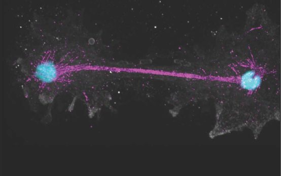 The Discovery of Incendiamoeba cascadensis: A Fire Amoeba